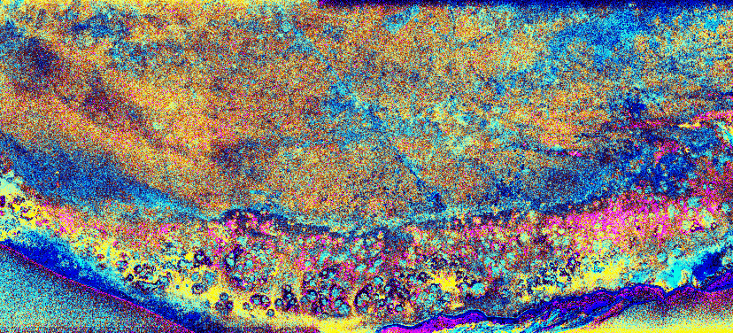
This is a radar image (1Mb)of
the southwest portion of the buried Chicxulub impact crater
in the Yucatan Peninsula, Mexico. The radar image was
acquired on orbit 81 of space shuttle Endeavour on April 14,
1994 by the Spaceborne Imaging Radar C/X-Band Synthetic
Aperture Radar (SIR-C/X- SAR). The image is centered at 20
degrees north latitude and 90 degrees west longitude.
Scientists believe the crater was formed by an asteroid or
comet which slammed into the Earth more than 65 million
years ago. It is this impact crater that has been linked to
a major biological catastrophe where more than 50 percent of
the Earth's species, including the dinosaurs, became
extinct. The 180- to 300-kilometer-diameter (110- to
180-mile) crater is buried by 300 to 1,000 meters (1,000 to
3,000 feet) of limestone. The exact size of the crater is
currently being debated by scientists. This is a total power
radar image with L-band in red, C-band in green, and the
difference between C- and L-band in blue. The
10-kilometer-wide (6- mile) band of yellow and pink with
blue patches along the top left (northwestern side) of the
image is a mangrove swamp. The blue patches are islands of
tropical forests created by freshwater springs that emerge
through fractures in the limestone bedrock and are most
abundant in the vicinity of the buried crater rim. The
fracture patterns and wetland hydrology in this region are
controlled by the structure of the buried crater. Scientists
are using the SIR-C/X-SAR imagery to study wetland ecology
and help determine the exact size of the impact crater. |
|