|
Brazos River, Texas, K/T boundary outcrops |
|
|
Brazos River, Texas, K/T boundary outcrops |
|
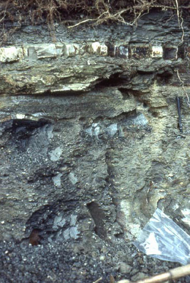 |
| The Brazos-1 outcrop in 1981, when it was still easily accessible and not oversampled |
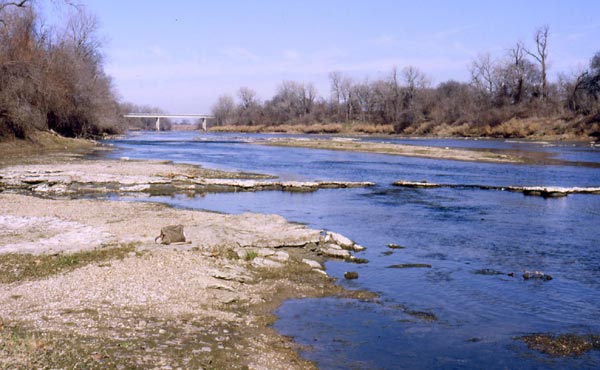 |
| The Brazos river, 1km south of Farm road 413 bridge. The resistant tsunami induced event beds form ledges, where rapids or waterfalls in the riverbed are formed (Falls on the Brazos!) |
| event bed | rippleforms | stratigraphy |
| grainsize data | caco3 data | darting minnows creek |
| Drill holes | spherule beds |
 |
The Brazos river K/T outcrops on Google Earth